Ditapis dengan

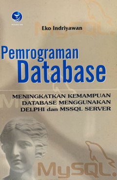
Pemrograman Database: Meningkatkan Kemampuan Database Menggunakan Delphi dan …
- Edisi
- Cet. 1
- ISBN/ISSN
- 979-763-821-9
- Deskripsi Fisik
- x, 260 hlm, 21 cm x 14 cm
- Judul Seri
- -
- No. Panggil
- Sir 005.74 EKO p
- Edisi
- Cet. 1
- ISBN/ISSN
- 979-763-821-9
- Deskripsi Fisik
- x, 260 hlm, 21 cm x 14 cm
- Judul Seri
- -
- No. Panggil
- Sir 005.74 EKO p

Pengolahan Database MYSQL 5 dengan Java 2 Disertai Teknik Pencetakan Laporan
- Edisi
- Cet. 2
- ISBN/ISSN
- 979-731-633-5
- Deskripsi Fisik
- vi, 214 hlm.; 14 cm x 21 cm
- Judul Seri
- -
- No. Panggil
- 005.74 RID p
- Edisi
- Cet. 2
- ISBN/ISSN
- 979-731-633-5
- Deskripsi Fisik
- vi, 214 hlm.; 14 cm x 21 cm
- Judul Seri
- -
- No. Panggil
- 005.74 RID p

Development of Bridges Maintenance Management System based on Geographic Info…
A Geographic Information System (GIS) is a computerized database management system for accumulating, storage, retrieval, analysis, and display spatial data. In general, GIS contains two broad categories of information, geo-referenced spatial data and attribute data. Geo-referenced spatial data define objects that have an orientation and relationship in two or three-dimensional space, while attr…
- Edisi
- Vol. 26 Issue 9
- ISBN/ISSN
- 1726-4073
- Deskripsi Fisik
- -
- Judul Seri
- -
- No. Panggil
- -

Usage and awareness of databases by faculty staff and post graduate students …
It is assumed that most of the King Faisal University (KFU) faculty members as well as graduate students are aware of the availability of the web based research databases in the university library but few of them are using it despite its contribution to the enrichment of the scientific research, the increase of the publication rate and quality of papers published by KFU researchers. Currently, …
- Edisi
- Issue 31
- ISBN/ISSN
- 1687-2215
- Deskripsi Fisik
- -
- Judul Seri
- -
- No. Panggil
- -

Database Design All in One: Theory, Practice and Case Study
- Edisi
- -
- ISBN/ISSN
- 978-602-04-7790-9
- Deskripsi Fisik
- viii, 315 hlm., 23 cm
- Judul Seri
- -
- No. Panggil
- 025.04 IND d
- Edisi
- -
- ISBN/ISSN
- 978-602-04-7790-9
- Deskripsi Fisik
- viii, 315 hlm., 23 cm
- Judul Seri
- -
- No. Panggil
- 025.04 IND d

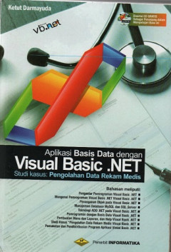
Aplikasi Basis Data dengan Visual Basic.Net
- Edisi
- Cet. 1
- ISBN/ISSN
- 978-602-1514-49-8
- Deskripsi Fisik
- xiv, 424 hlm.; 23 cm
- Judul Seri
- -
- No. Panggil
- 006 KET a
- Edisi
- Cet. 1
- ISBN/ISSN
- 978-602-1514-49-8
- Deskripsi Fisik
- xiv, 424 hlm.; 23 cm
- Judul Seri
- -
- No. Panggil
- 006 KET a

Sistem Informasi Penjualan dengan PHP dan MySQL
- Edisi
- Ed. 1.--
- ISBN/ISSN
- 978-602-8545-29-7
- Deskripsi Fisik
- xxi, 292 hlm.:illus.; 23 cm
- Judul Seri
- -
- No. Panggil
- 005.262 RIY s
- Edisi
- Ed. 1.--
- ISBN/ISSN
- 978-602-8545-29-7
- Deskripsi Fisik
- xxi, 292 hlm.:illus.; 23 cm
- Judul Seri
- -
- No. Panggil
- 005.262 RIY s

Sistem Berkas
- Edisi
- Ed. 1
- ISBN/ISSN
- 978-979-29-4039-8
- Deskripsi Fisik
- xii, 168 hlm.; 23 cm
- Judul Seri
- -
- No. Panggil
- 005.74 WAH s
- Edisi
- Ed. 1
- ISBN/ISSN
- 978-979-29-4039-8
- Deskripsi Fisik
- xii, 168 hlm.; 23 cm
- Judul Seri
- -
- No. Panggil
- 005.74 WAH s

AVR Atmel: Objek Oriented Programming Using C++
- Edisi
- Ed. 1.--
- ISBN/ISSN
- 978-979-29-3576-9
- Deskripsi Fisik
- xvi, 200 hlm.; 21 cm
- Judul Seri
- -
- No. Panggil
- 005.11 SID a
- Edisi
- Ed. 1.--
- ISBN/ISSN
- 978-979-29-3576-9
- Deskripsi Fisik
- xvi, 200 hlm.; 21 cm
- Judul Seri
- -
- No. Panggil
- 005.11 SID a

Visual C++ 2013
- Edisi
- Ed. 1.--
- ISBN/ISSN
- 978-979-29-5070-0
- Deskripsi Fisik
- xii, 272 hlm.; 23 cm.
- Judul Seri
- -
- No. Panggil
- 005.11 VIS
- Edisi
- Ed. 1.--
- ISBN/ISSN
- 978-979-29-5070-0
- Deskripsi Fisik
- xii, 272 hlm.; 23 cm.
- Judul Seri
- -
- No. Panggil
- 005.11 VIS
 Karya Umum
  Filsafat
  Agama
Agama  Ilmu-ilmu Sosial
  Bahasa
  Ilmu-ilmu Murni
  Ilmu-ilmu Terapan
  Kesenian, Hiburan, dan Olahraga
  Kesusastraan
  Geografi dan Sejarah